Making cultures tangible
A proposal for a series of small, meaningful spatial interventions that are tied in with events that leave imprints in both the minds of people for San Lorenzo Village and the spaces around them .
Alameda Point
A sustainable masterplan for sea level adaption of the island and the redevelopment of the former Naval Air Station.
InCREAsing_acTIVITY
It is a project aimed at developing a participatory urban planning process based on the active participation of citizens in order to strengthen the creative economy of the city of Thessaloniki.
A walkable canal city
A sustainable masterplan following environmental design principles for Pazhou Island in the Pearl River , China.
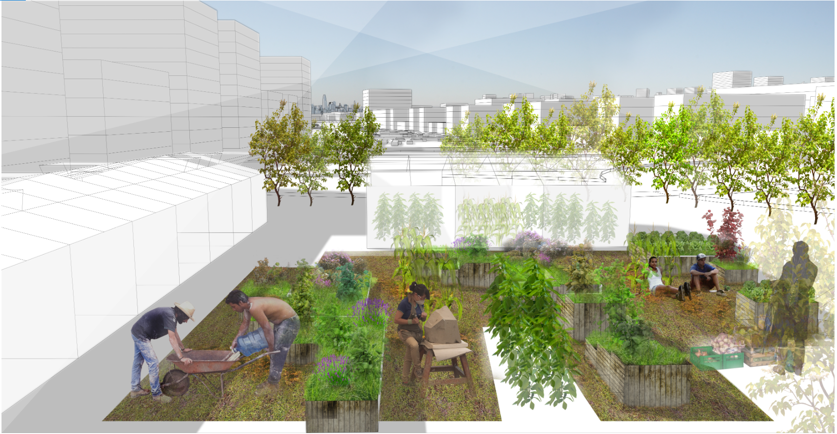
Fix-it_Creative recycling
The “Fix-it!”- proposal is a quick, sketch-like suggestion for the meaningful re-use of an industrial wasteland, giving to a “brown field” a new life and look.
![]() InCREAsing_acTIVITY
InCREAsing_acTIVITY
Project Thesis at Architecture School of
Aristotle University of Thessaloniki
Project Collaborator: Maria Latinopoulou
Supervisors: Komninos Nicos, Christodoulou Charis
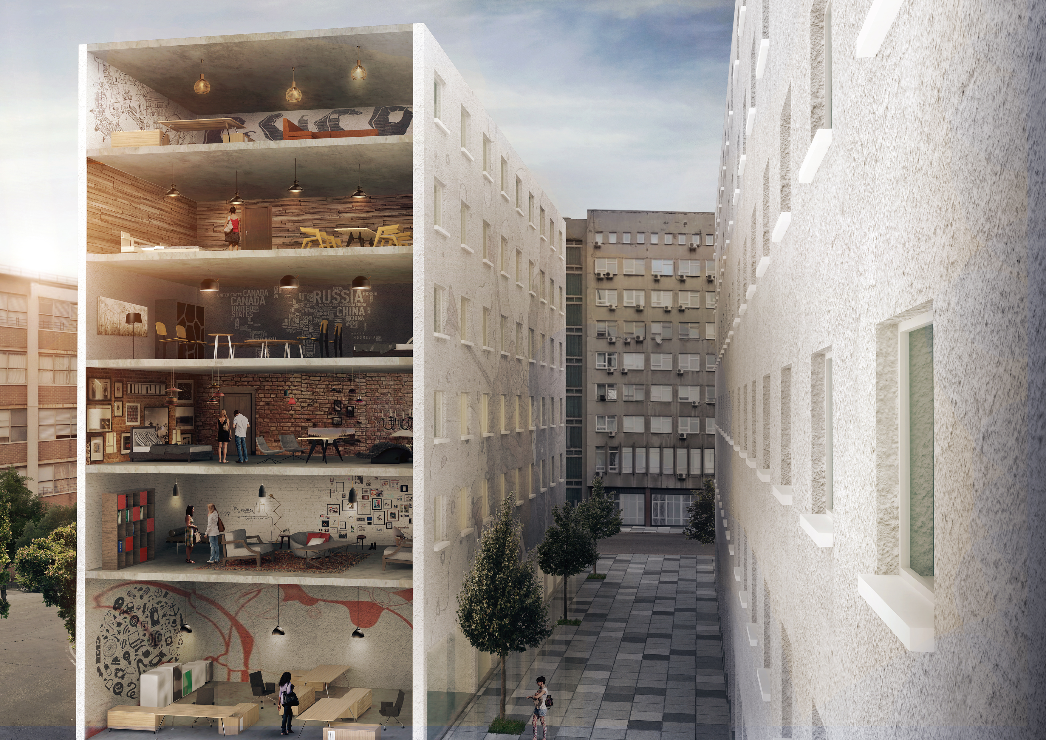
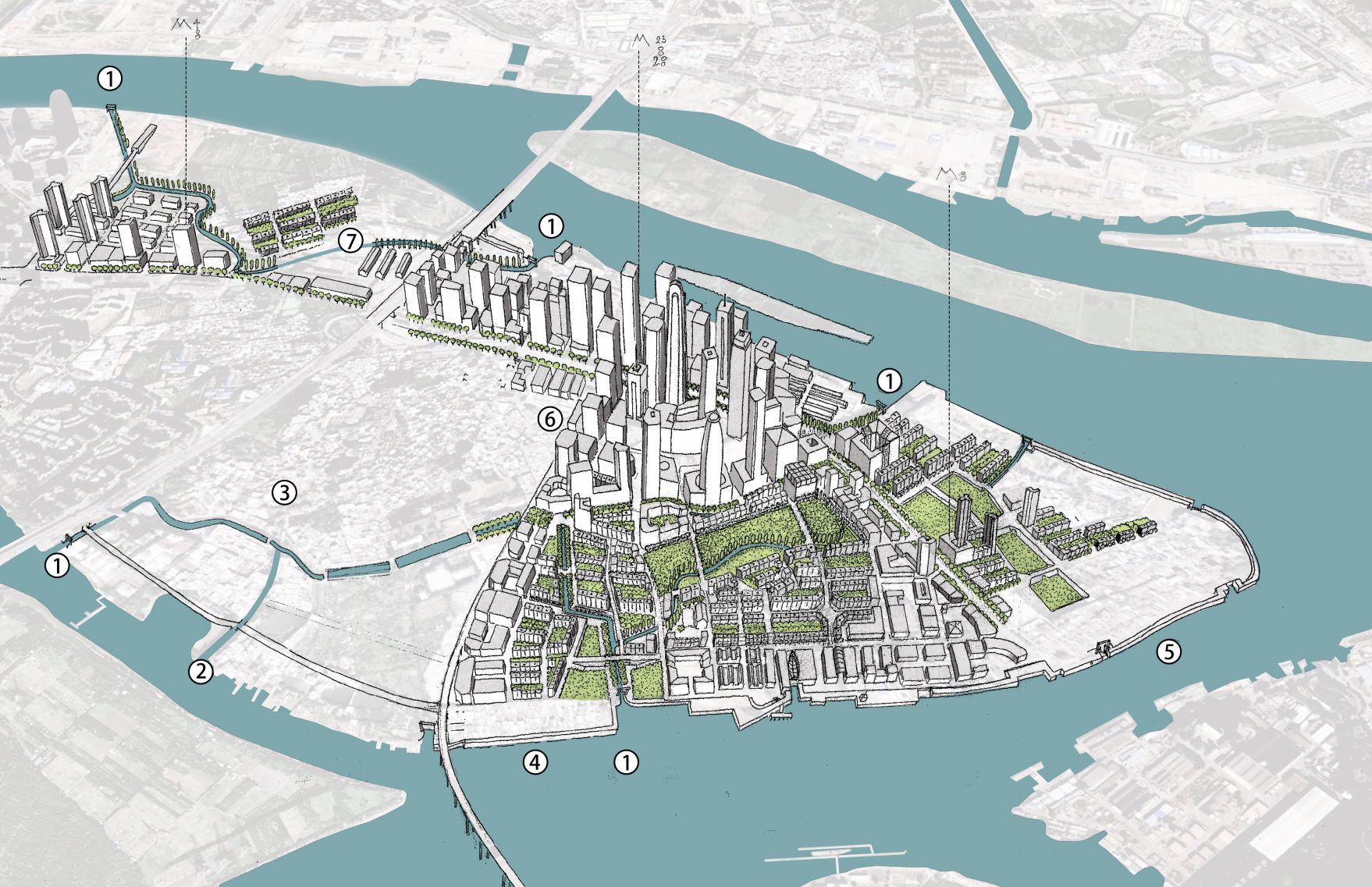
InCREAsing_ACTIVITY is a project aimed at developing a participatory urban planning process based on the active participation of citizens in order to strengthen the creative economy of the city of Thessaloniki. The field of the research is an area next to the city center.
The idea was initiated by the identification of individual components of creative economy within the city.
Our efforts to focus on a bottom-up approach to creating a city where people become carriers of change, created new opportunities for participatory processes (site investigations, mind maps, questionnaires).
Thus, the regeneration is carried out through collective design, so that the area will be an organized activity receptor. In the first stage, the area is proposed to be classified as a highly productive area.
After examining the results of the participatory process and the three sugested strategic planning sxenarios, we concluded in a strategic plan that contributes a critical mix of all the above.
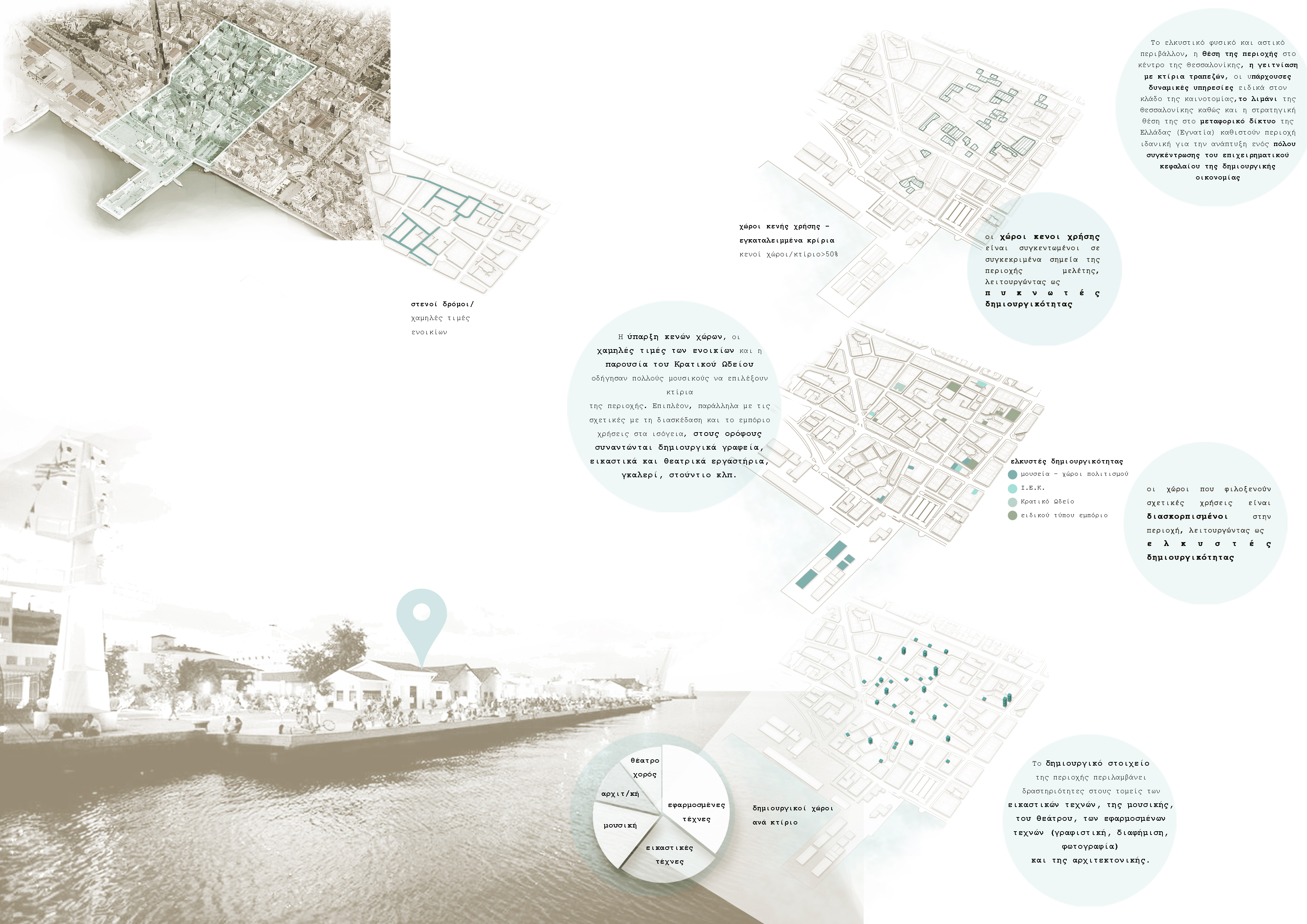


Then the creation of a network of pedestrian and light traffic roads takes part, in order to upgrade the quality of public space and the experience of users in the area, followed by the formation of squares to enhance the interest of the region and to form action receptors. Public-private partnerships are suggested for the development of certain buildings located throughout the area.
These buildings will accommodate public uses related to the production and promotion of the work of creative groups and individuals. As for the spatial organization, the region consists of 5 localities which, despite their different character and different identification features, will form a dynamic whole.

A quick site analysis revealed the strengths and weaknesses of the site.
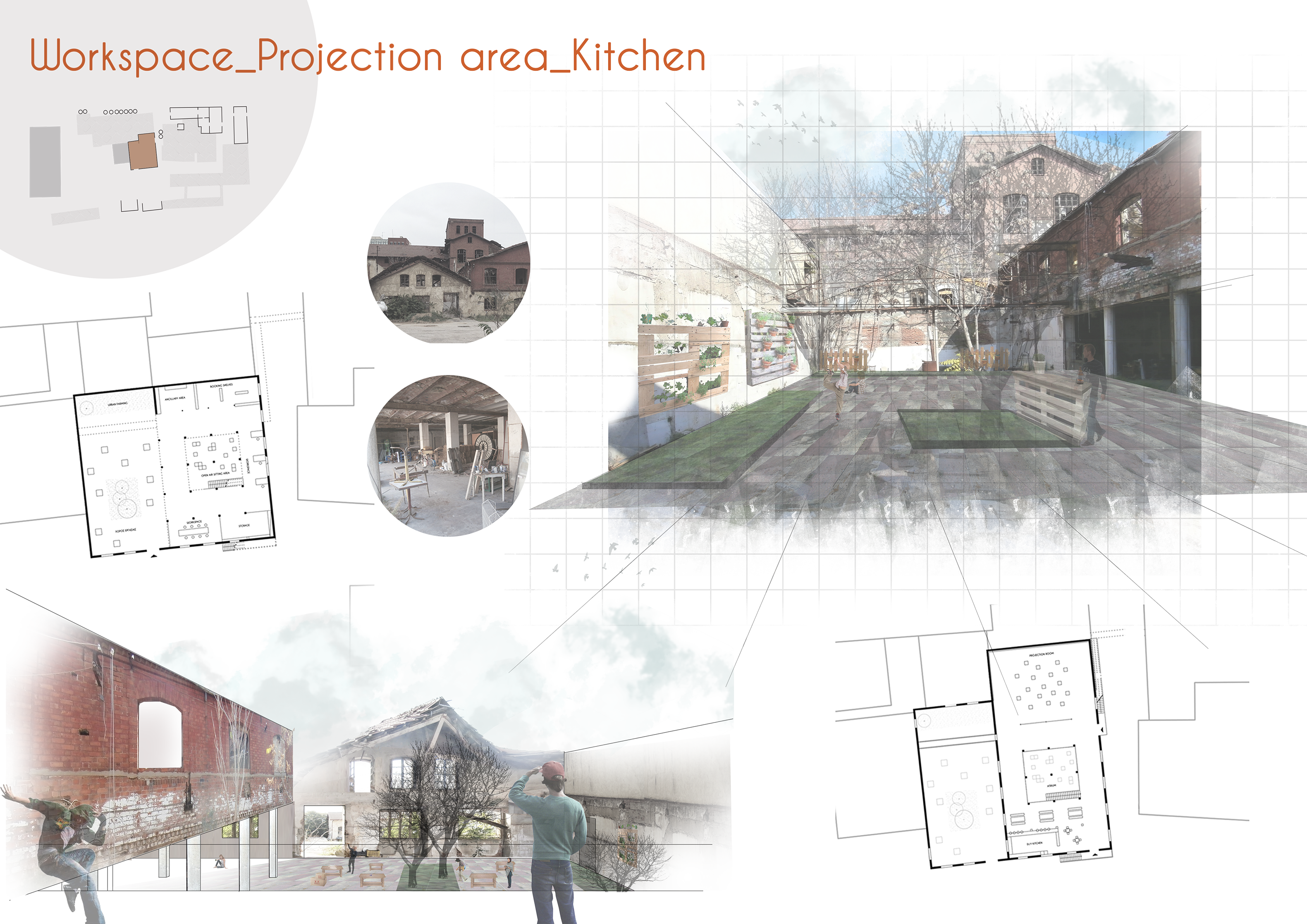
The “Fix-it!”- proposal is a quick, sketch-like suggestion for the meaningful re-use of an industrial wasteland, giving to a “brown field” a new life and look , thus suggesting the new-open ithe society- nature of the program itself. The impulse of the project can reach far beyond the constraints of the site.

Workshop Project 6
Ecoweek in Thessaloniki 2016
Workshop Leader Ulf Meyer
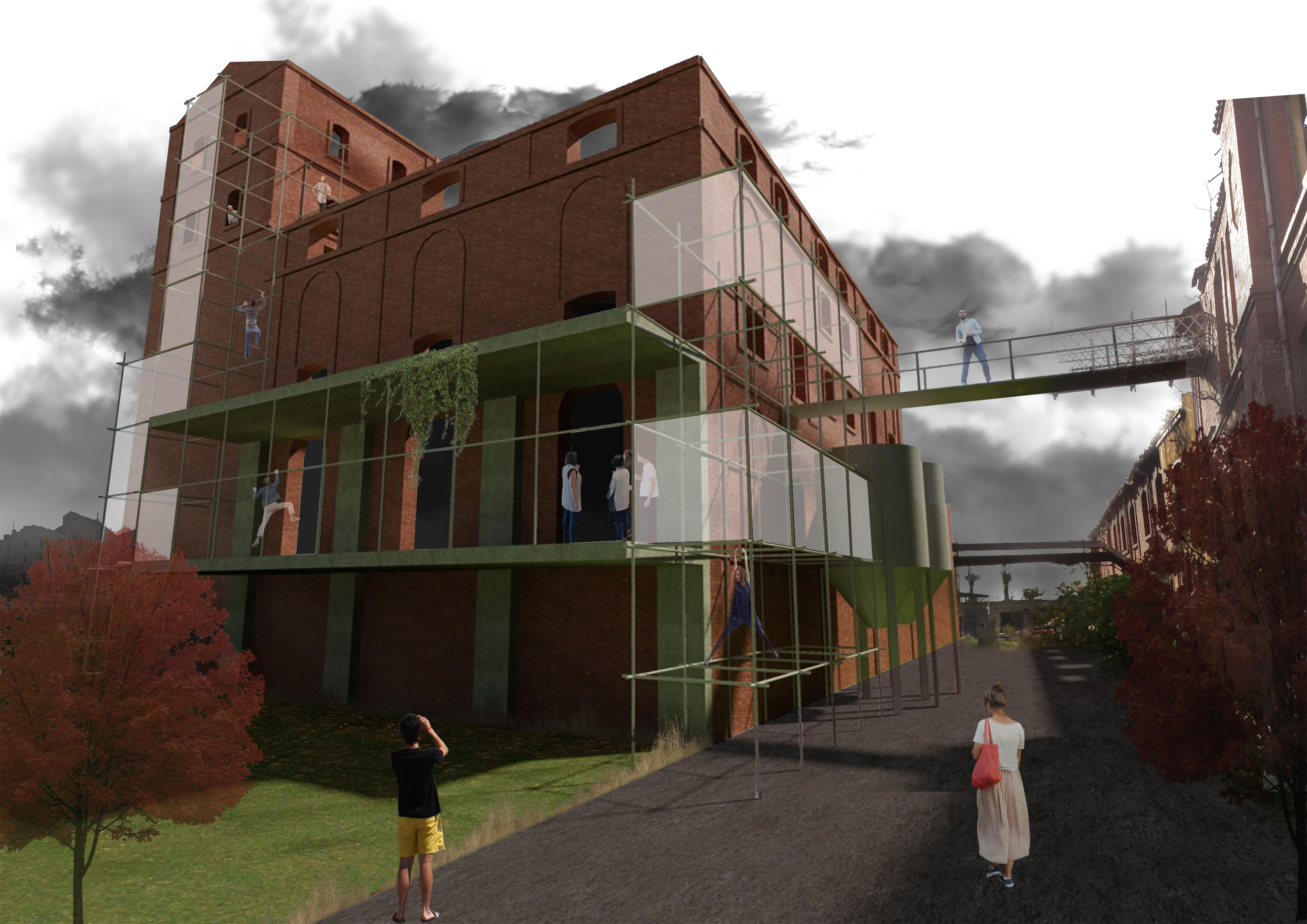
Currently, the abandoned former “Fix”-Brewery is an unsafe ruin that is delapitating quickly. Beer was brewed here for a hundred years, from the 1880s to the 1980s, when the buildings fell into disrepair. The Fix ruin now frames the Western City entrance to Thessaloniki. Car-dealers and music venues are the only commercial users. However, some alternative cultural institutions on site have already started giving the area a new life.
This “Fix-it!”-project wants to support this reclamation by proposing turning some part of the site into a recycling-/ up-cycling center.
The idea is to use simple, low-budget and low-tech architectural interventions and connect them by means of two paths: A “path of material” and a “path of people”.

The path of the material starts with four “stations” in the city of Thessaloniki, where people can bring their un-used objects and materials. From here, they get transported to the site and separated into glass, wood, paper, plastic etc.
The items are displayed and sold in the market-area, near a central inner plaza that acts as the new heart of the Fix-Brewery-Site. Visitors (and staff) arrive from the west and/or north, from the Street “26 October” with the round former beer tanks acting as attractive visual magnets to mark the entrance(s).
![]()
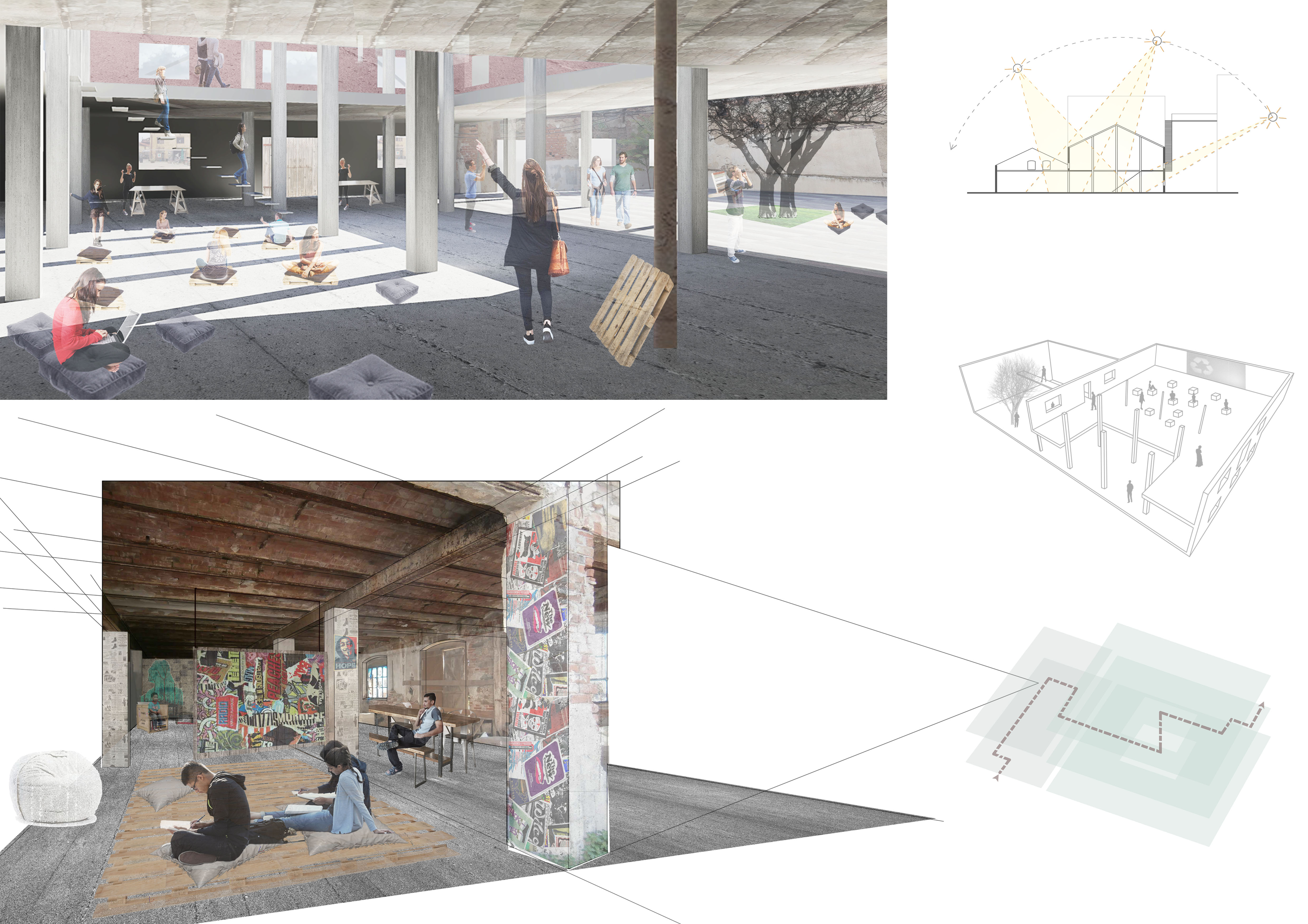
In the workshop next-door artists and craftsmen turn the collected objects and materials into useable, even artistic items – Visitors can see and experience “Creative Recycling” at work! There are drills, saws, tools and equipment for the craftsmen. Some heavy machinery can be seen in action, but behind glass, to avoid unpleasant smells, dust and noise.
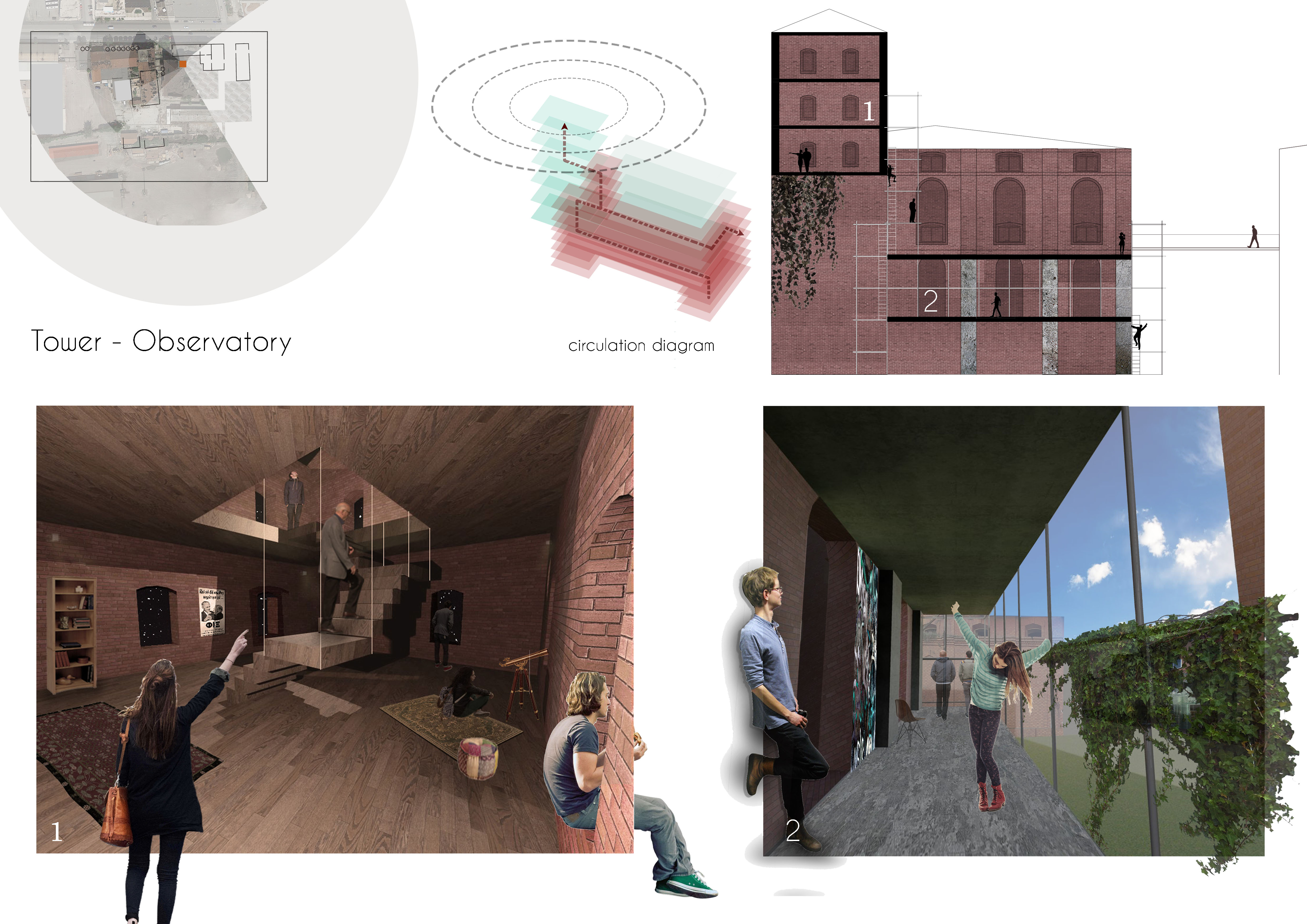
A loop guides visitors through the workshops. The workshop visit is followed by an optional visit of the refurbished brewery tower. A panoramic view of “old” and “new” and over the whole western city of Thessaloniki is to be enjoyed from here. The path upstairs is made of simple scaffolding that acts as an external “prosthetic”.
![]()
![]()
The voyage of creative recycling continues over a bridge in the second upper floor to the self-service café/canteen with vegetation, urban farming and outdoor-seating. It finds place in two adjacent brick buildings that overlook the nearby Plaza and martket. The ruined building remains roof-less and acts as a semi-outdoor space, while a cut in the neighbouring building brings natural daylight into the depth of the building. It also contains private workstations, a library and cinema. Throughout the design proposal, the dominant brick architecture is preserved.
![]()
![]()
The items are displayed and sold in the market-area, near a central inner plaza that acts as the new heart of the Fix-Brewery-Site. Visitors (and staff) arrive from the west and/or north, from the Street “26 October” with the round former beer tanks acting as attractive visual magnets to mark the entrance(s).

In the workshop next-door artists and craftsmen turn the collected objects and materials into useable, even artistic items – Visitors can see and experience “Creative Recycling” at work! There are drills, saws, tools and equipment for the craftsmen. Some heavy machinery can be seen in action, but behind glass, to avoid unpleasant smells, dust and noise.
A loop guides visitors through the workshops. The workshop visit is followed by an optional visit of the refurbished brewery tower. A panoramic view of “old” and “new” and over the whole western city of Thessaloniki is to be enjoyed from here. The path upstairs is made of simple scaffolding that acts as an external “prosthetic”.
The voyage of creative recycling continues over a bridge in the second upper floor to the self-service café/canteen with vegetation, urban farming and outdoor-seating. It finds place in two adjacent brick buildings that overlook the nearby Plaza and martket. The ruined building remains roof-less and acts as a semi-outdoor space, while a cut in the neighbouring building brings natural daylight into the depth of the building. It also contains private workstations, a library and cinema. Throughout the design proposal, the dominant brick architecture is preserved.

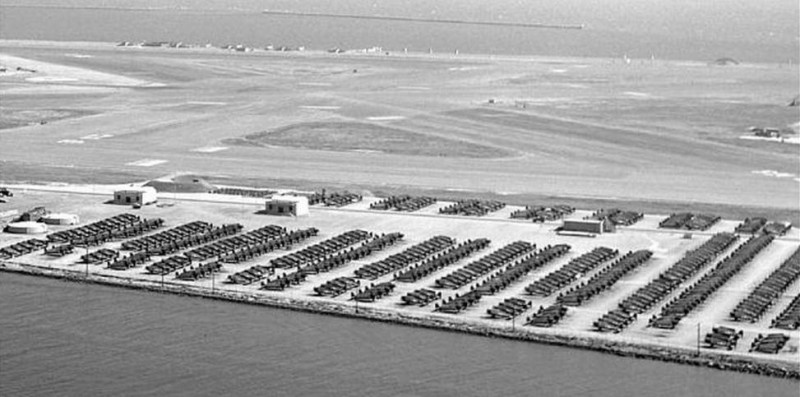
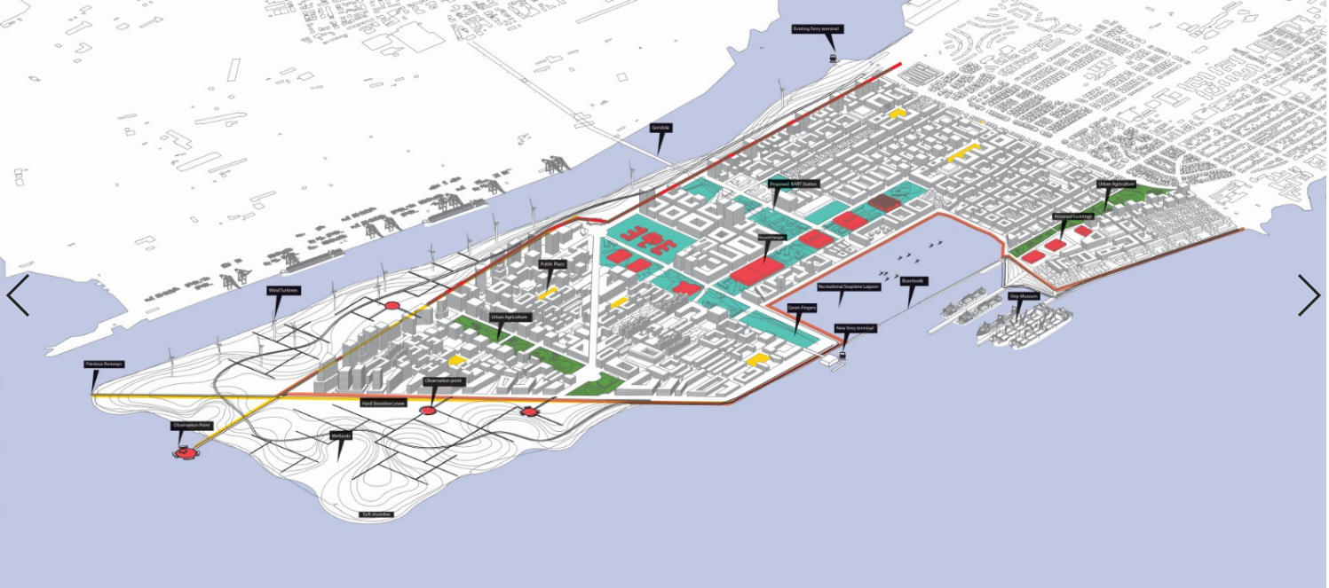
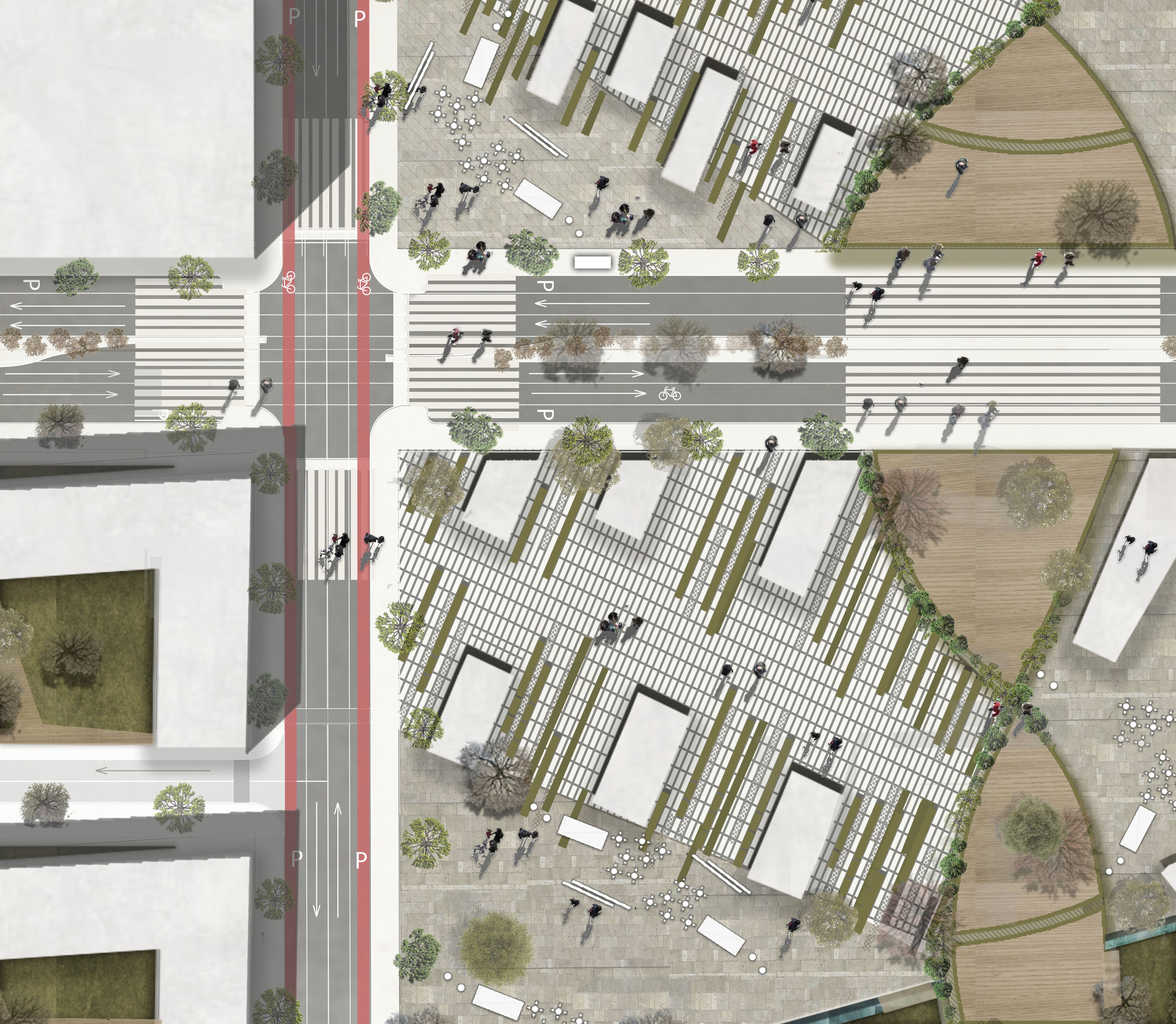
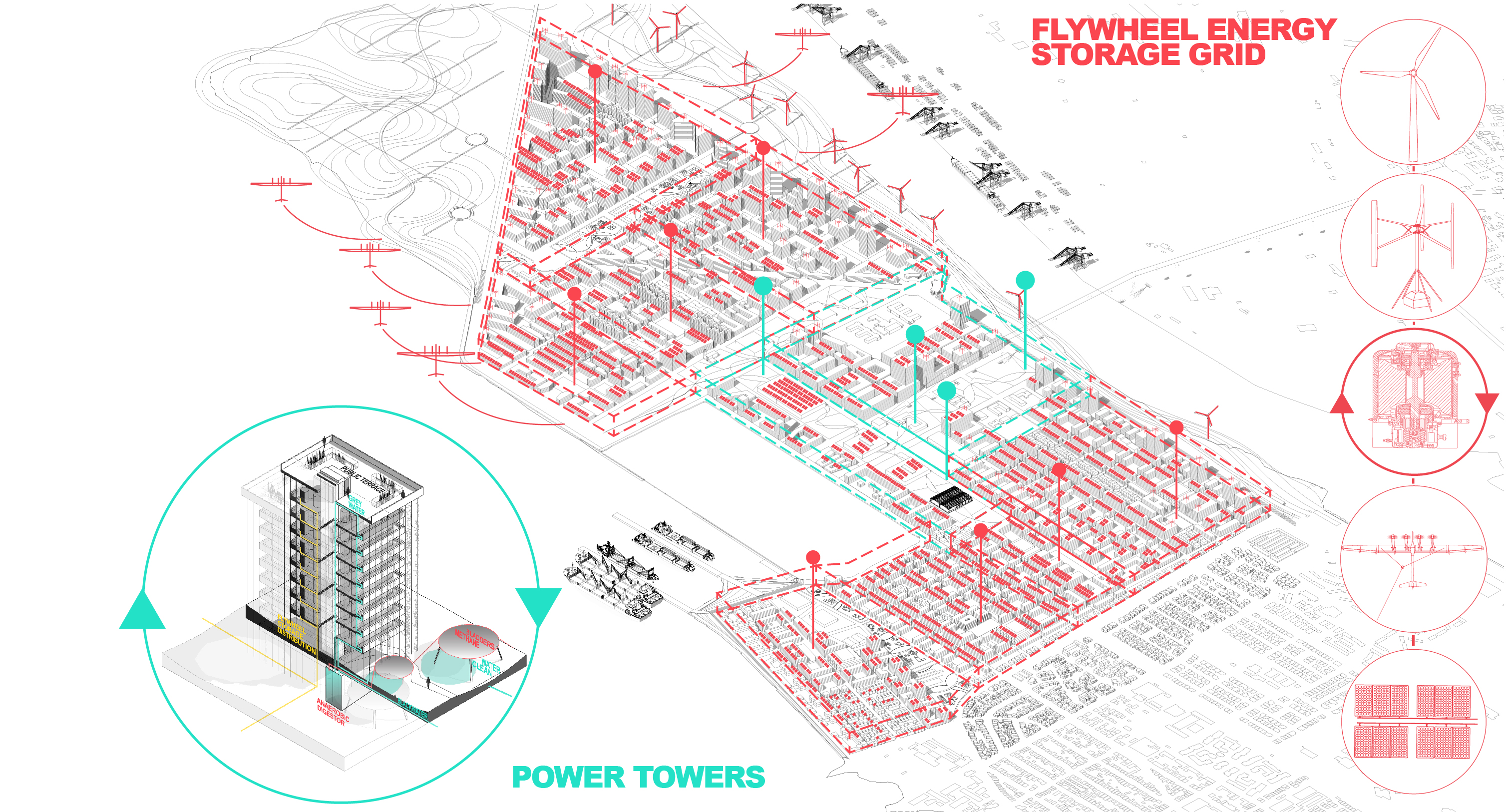
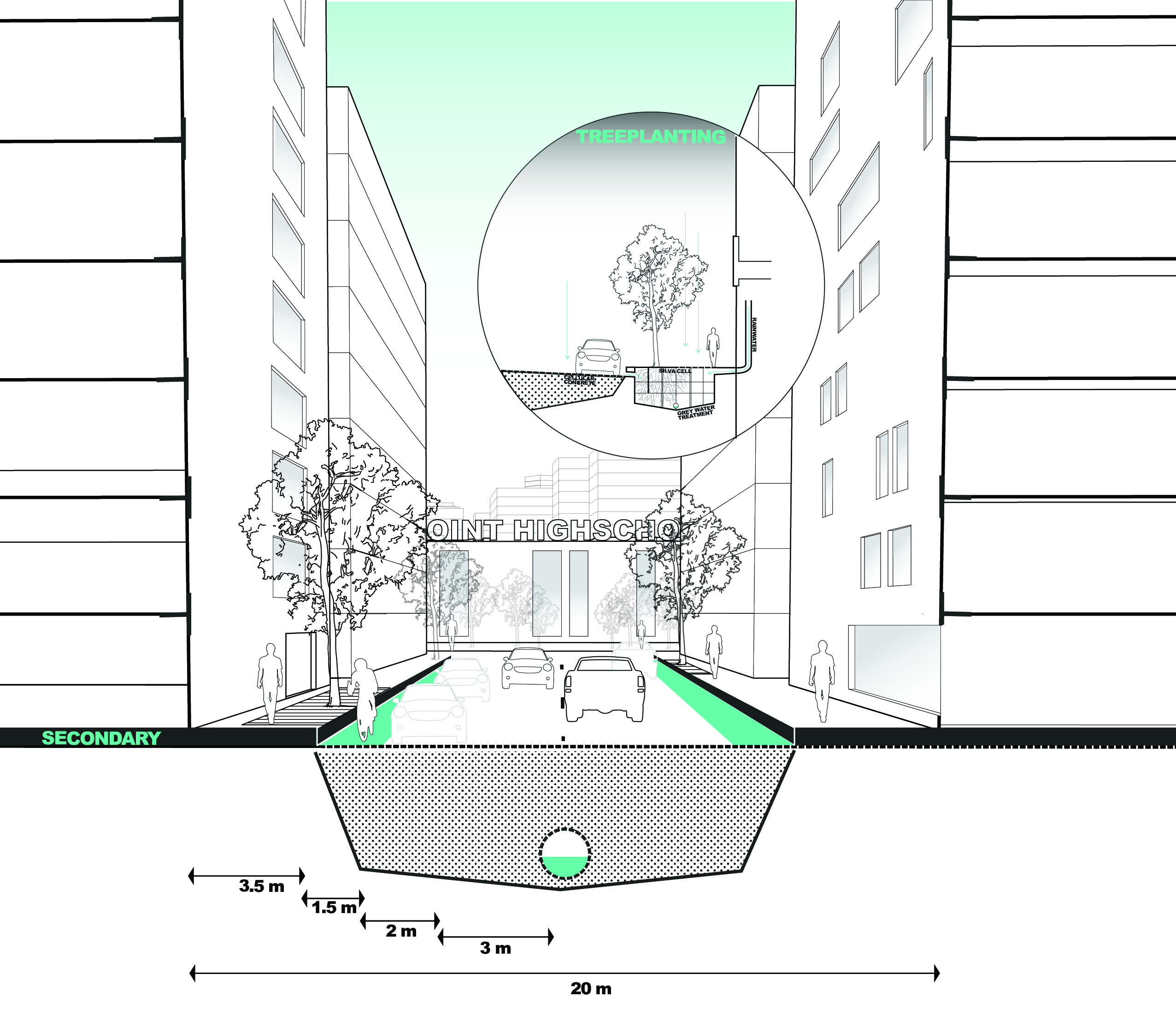
ALAMEDA POINT
A sustainable masterplan for sea level adaption of the island and the redevelopment of the former Naval Air Station.
UC Berkeley · Urban design studio · Fall 2018
· Group project collaborators: Robin Hueppe,
Gerrard Allam · Supervisor: John Ellis


“RETURN TO NATURE”

The plan aims to allow Alameda Point to return to nature. Wetlands will mitigate sea level rise, provide a biodiverse sanctuary, a boardwalk park, and highlight views of the bay.


L
Neighborhood

Street Hierarchy

Boulevard


Sea-level rise poses major challenges
to coastal land uses, and therefore to urban planning processes. In theory, if done well, urban planning can lead to responses to sea-level rise that are socially and environmentally sustainable. The proposal aims to achieve successful adaptation to sea-level rise.
The overarching goal of the Alameda group is the concept of human-centered design. By using this approach, the triple helix comprising socio-spatial, socio-economic and socio-ecological factors is the underlying theoretical idea to structure the concrete goals thematically.
This methodology provides the opportunity to evaluate the program goals on their value to the present community of Alameda. Moreover, they will immediately respond to the big challenges that the entire Bay Area is facing.
CONCEPT DRIVERS
“GLIMPSES OF THE PAST”
Alameda Point was once an important Naval Base. The proposed scheme intends to highlight the historical significance by retaining numerous elements that characterized the base.

M
Block
Green Fingers
Transit Network
Shared Street

Community Recreation Area
1993
![]()
![]()
Current Masterplan (2020)
![]()
Proposed Masterplan (2050)
![]()
“GRAVITATIONAL POINTS”
![]()
Neighborhoods were always at the core of the design. Nine neighborhoods are sprinkled throughout the plan. Each one with its own center within 5-7 min walk-shed.
![]()
![]()
![]()
S
Building
![]()
![]()
Sustainability network
![]()
Local Street
![]()
Current Masterplan (2020)
Proposed Masterplan (2050)

“GRAVITATIONAL POINTS”
Neighborhoods were always at the core of the design. Nine neighborhoods are sprinkled throughout the plan. Each one with its own center within 5-7 min walk-shed.
S
Building

Sustainability network
Local Street
Bay Area View-point

Birds Observatory
Seating Area
Pool


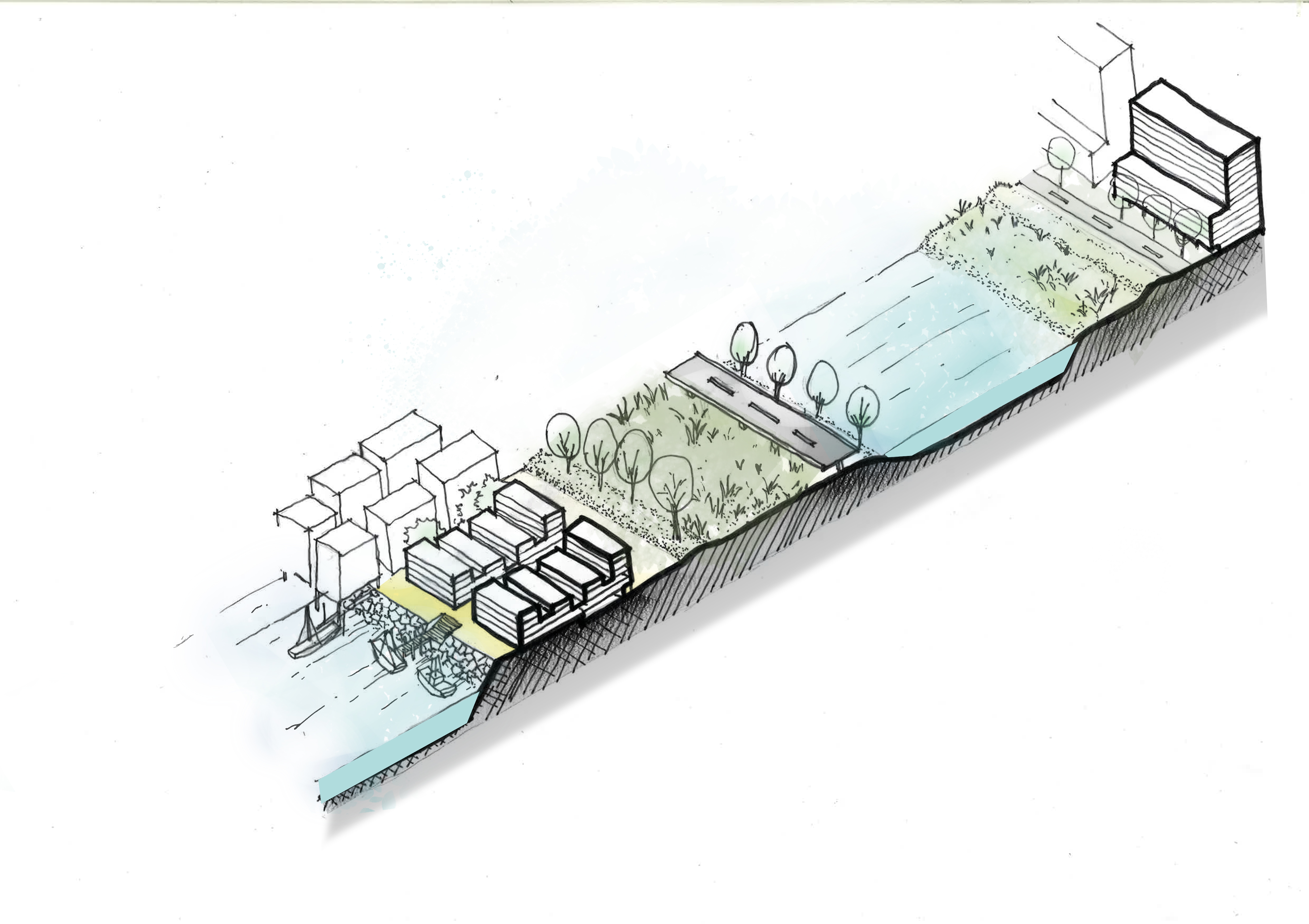
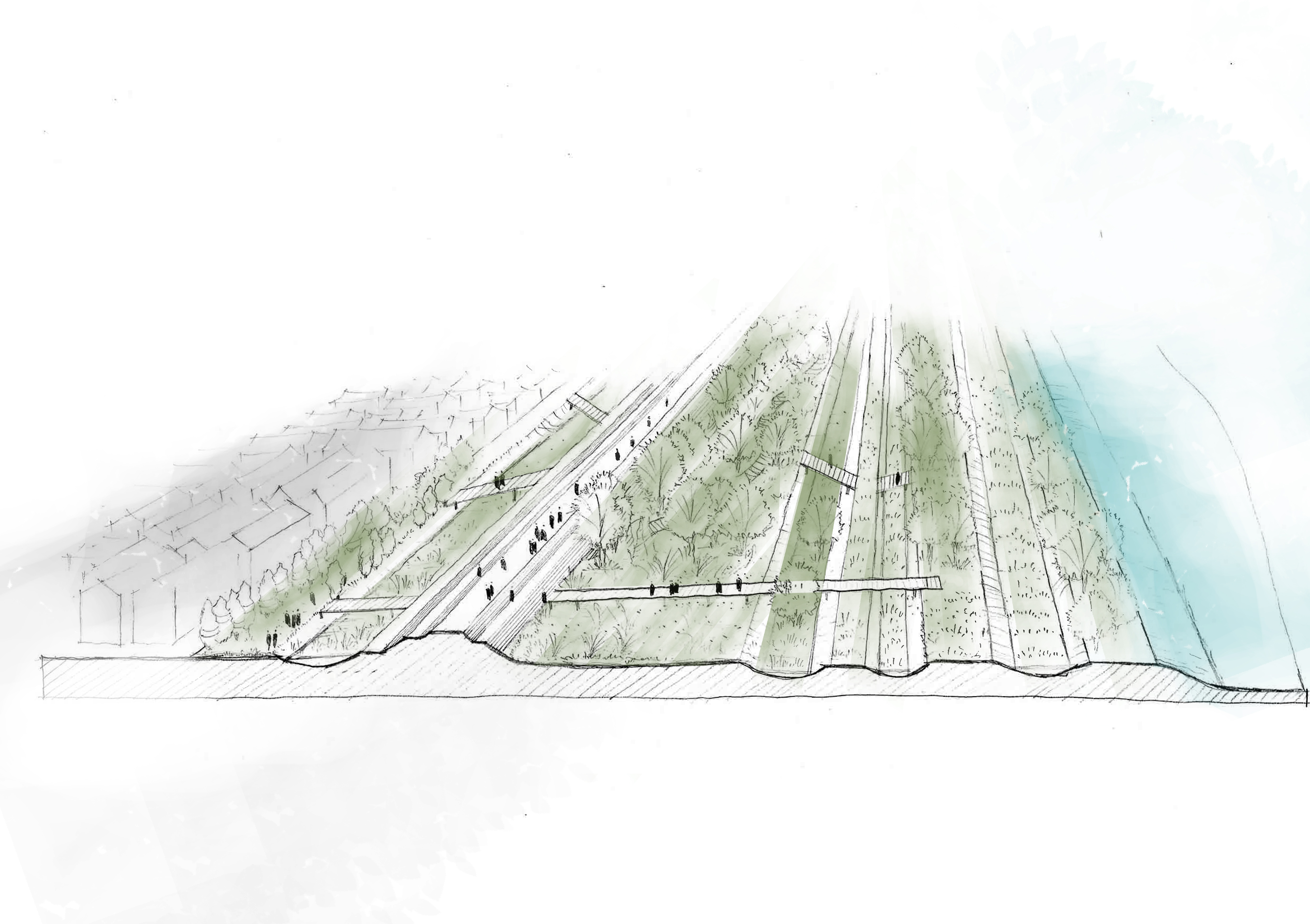
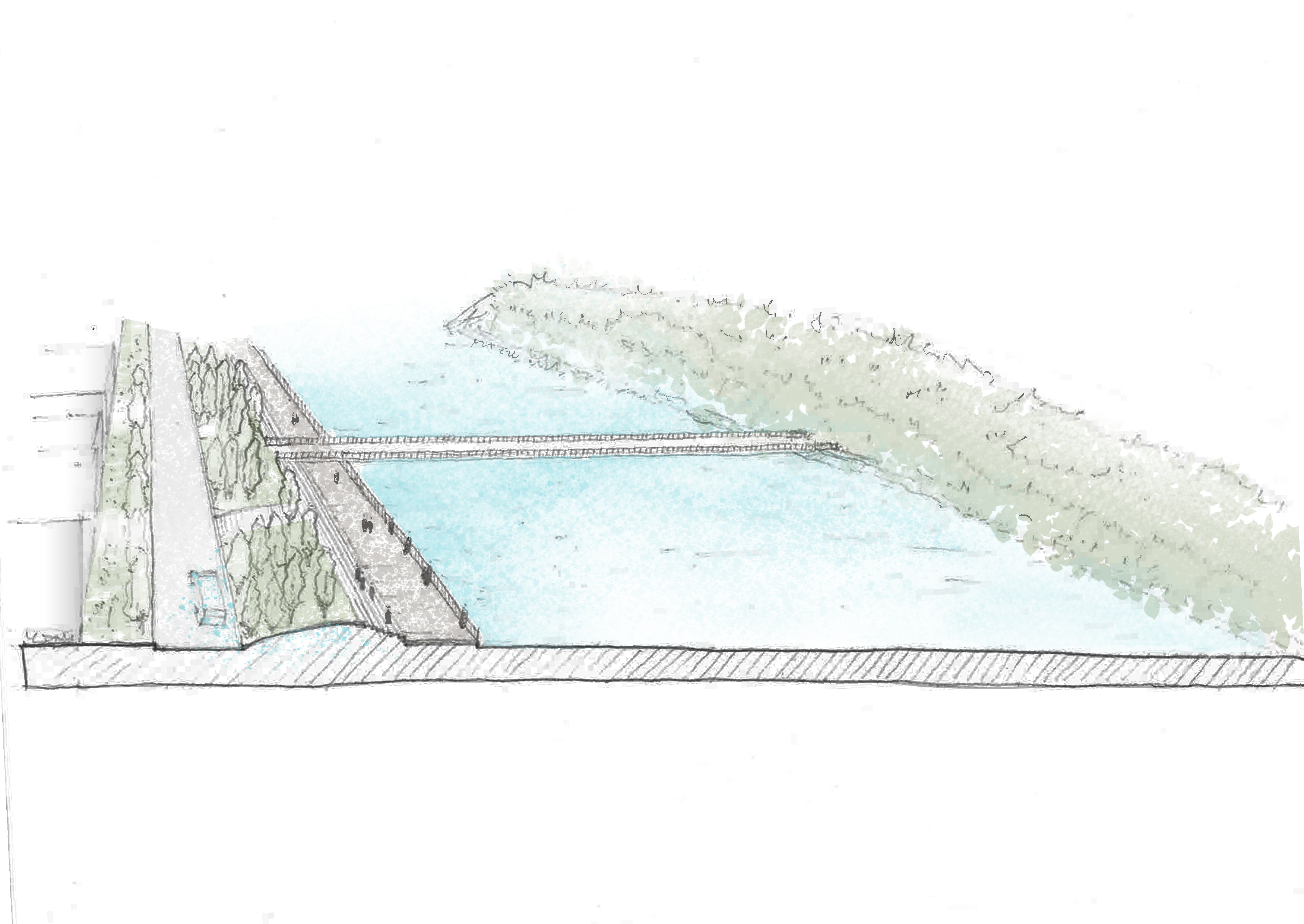
“A WALKABLE CANAL CITY”
A sustainable masterplan for Pazhou Island • water management ·• environmental design,
Urban design Workshop at Guangzhou organised by SCUT-UC Berkeley
Group project collaborators: Sihan Sun, Bilin Chen, Dengyue Wang, Mingqi Xue
Supervisor: Peter Bosselmann
Keywords: Pearl River Delta, Pazhou Island, water management, adaptation of urban form
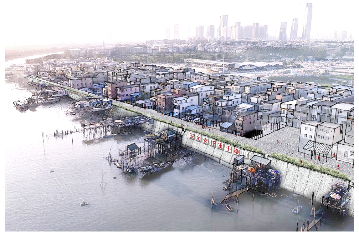
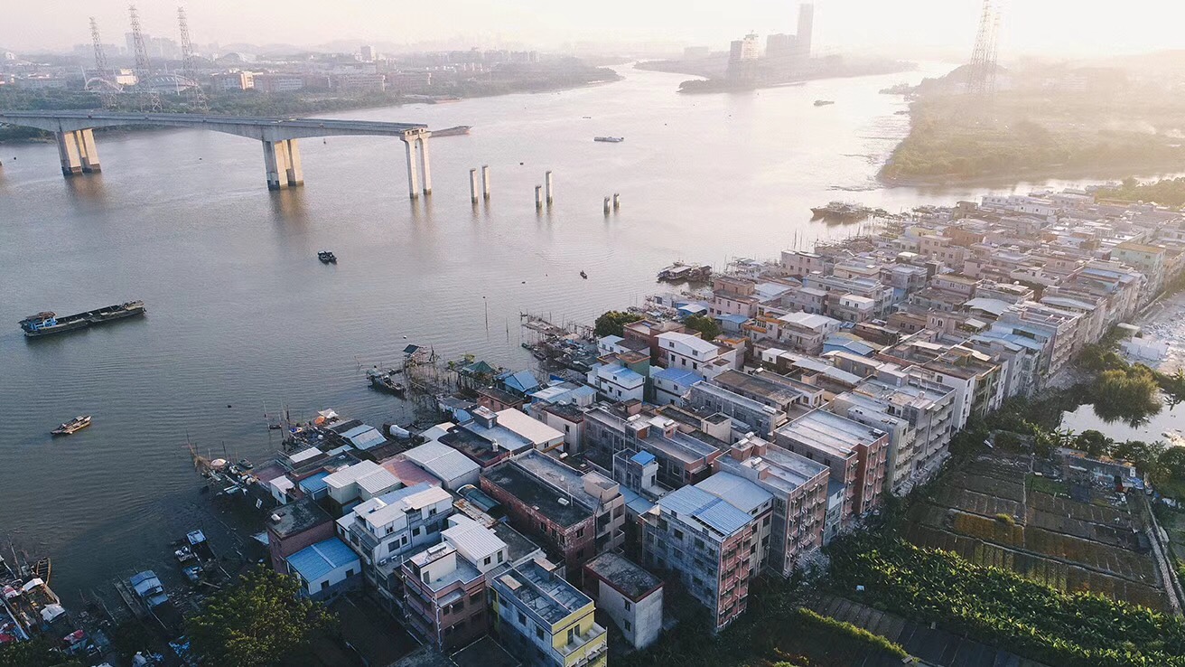
Pazhou Island is located directly to the south of Guangzhou’s central city in China’s Pearl River Delta. As reflected in historical maps, the island was formed by long-term a cretion of river sediments around two rock outcrops between the front channel of the Northern Pearl River and the Whampoa Canal. Eye-level renderings depict how one of the two rock outcrops provided foundations to the 16th century Pazhou Pagoda, which was a key landmark for ocean-going sailing ships ascending from the Humen Estuary to the natural port at Whampoa Harbor.
Whampoa village on Pazhou Island remained a sizable urban settlement on the second rock outcrop of the island With the opening of the Pearl River Delta region to foreign investments Guangzhou experienced explosive growth since the 1980s, Pazhou Island’s strategic proximity to Guangzhou’s financial district has made it a prime location for urban development, and the western portion of the island became part of media and new technology district in the second decade of the 21st century.
In light of current proposals to turn the eastern part of the island into a major commercial concentration of the new Pearl River Bay polycentric region, we contrast two development scenarios and analyzed how well each could provide for the water storage required during heavy typhoonal rains, and the protections needed against riverine flooding and tidal surges.
One team worked on the scenario that would develop all available land, while the our team worked on the scenario that would leave currently low-lying land available as wetlands that can be flooded during storm events.

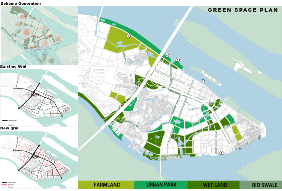


We concluded with recommendations to the regional government for adaptable designs of the island perimeter for flood protection and for adaptable design of water storage in low-lying unbuilt areas, and also under parks and roads, on roof and inside buildings. We also delineate alternative future conditions for the villages on the island, including a fishing village that is openly exposed to typhoonal wind and waves along the island’s south-eastern shore.
Stormwater management: During periodic floods the island performs like a sponge. Six sizeable sloghs dissect the eastern portion of the Pazhou Island. Climate change will call for adaptability of designs to accomodate flooding conditions. These conditions, once considered extreme and rare, are now more frequently occuring. A world class design of Pazhou Island would take a long range view that prepares urban districts for catastrophic events, simply because forsight will help prevent physical and social disasters.